(Click image above to view larger image/download)
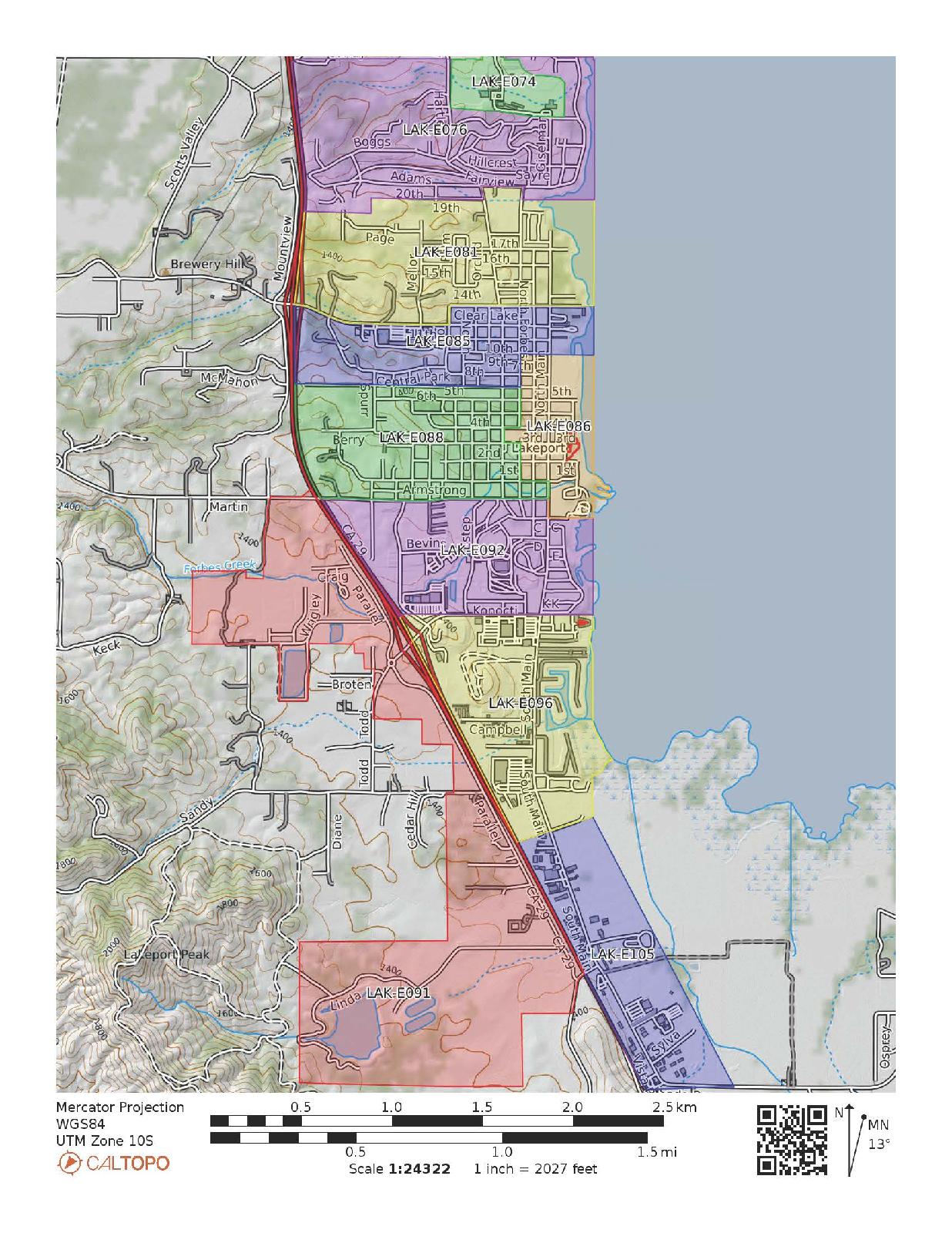
City of Lakeport Emergency Evacuation Map (GeoPDF)
Emergency Preparedness is our ever present goal, and concern!
With much assistance from the Lake County Sheriff's Office, the City of Lakeport has a new version of our Emergency Evacuation Map that is NOW available to our Community members.
You will see this PDF map includes color-coded Zones, each containing their ZoneHaven identifications. What you can't see is that this map is Geo-Spatially referenced, which allows YOU to locate yourself without the need of internet, wi-fi or other network connections, just your mobile device's built-in GPS service. This is even more exciting news for users of GeoPDF applications, such as: Avenza, Global Mapper, and others. It allows you to use the app you install on your mobile deices to know where you are at on the map at any time (QR Code at the bottom of the map eases importing it into your GeoPDF app).
Visit our website, https://www.cityoflakeport.com/police/index.php where you will find a link to the Evacuation Map GeoPDF, for download.